Main Page
Welcome to Sprowston Heritage The Heritage Archive was set up as a millennium project to record the history of the Parish of Sprowston and continues this task now Sprowston has become a town. This change emphasises how the history of an area evolves, a process that has been ongoing for centuries, this must raise the question, what is Sprowston? The provincial boundaries have changed over the years but unfortunately are still not the same as ecclesiastical and diocesan equivalents. To add more uncertainty there is the identity of the population, where do they perceive they live? After years of boundary changes many will still identify with the previous parish they lived in. At present, the archive is being rebuilt having originally been designed based on the COMMA Archive System which has been outmoded by recent advances in computer technology. The aim is to provide an archive which is computer-based and readily accessible to both residents and researchers. Whilst the archive has some local artefacts, lack of storage and display space precludes us from growing this collection, but we would welcome both photographs and documents relating to Sprowston. These may be copied for the archive; the original being returned to the donor. |
Funding Sprowston Heritage is supported by the Broadland District Council The group was founded in 1999, receiving funding from the National Lottery Heritage Fund Contact Us | Meeting Schedule | Administration | Contribute
To view and search images on the archive click on the link below. |
William 1st decreed that a record of the lands of England be made, thus the Domesday Book came into being in 1086.
So the area known as Sprow's settlement was re-named Sprowestuna-tun meaning settlement, enclosure or farm.
The Domesday Book lists the Manors of the Mounteney and Aslaks (Aslakes), Manor meaning the lands attached to the mansions of the owners.
Although Sprowston consisted of a large area north of the City of Norwich and spreading out to Beeston, Catton, Thorpe plus tracts of woods and heath, the population was small.
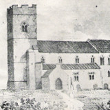
The Parish Church was completed in the 14th century, although there is evidence of the church in the records, dating from the early part of the 12th century. This confirmed the steadfastness of those in the Parish.
However the Black Death in 1348-1368 caused loss of life and along with farming changes, led to movement in areas of habitation. Heathland supported sheep farming and the woollen cloth trade, until in the 1400s arable farming expanded, leading to changes involving greater numbers of farm workers but fewer shepherds.
In the 15th century, Sprowestuna become one community and in 1560 Sprowston Hall was built near the church proving Sprowston to be a single Manor and Parish.
Naturally significant changes in boundaries, population and employment occurred during the following centuries. In 1850, the population was 1308, in School Road, Sprowston, the Elementary National School was built and St. Cuthberts Church was opened in 1885.
Sprowston Parish Council was established in 1894 and by 1901 the population was 2359. Other schools, recreation ground and park followed.
In 1976 the population was 17,800, and Sparhawk Park was created.
In 1982, a sports field was opened at Barkers Lane and in 1988, Council Offices formed.
Sprowston Parish Councillors debated whether the Parish of Sprowston should become a Town and so in October 2011 they voted with one accord to become a Town, (Town denotes an urban area with a name, boundaries, local government, shopping and business areas, plus being larger than a village.
A Town may have a Mayor and Deputy Mayor instead of a Chairman and Vice-Chairman. Between 15th May 2019 and 17th May 2022 Sprowston Town Council had a Town Mayor. On 18th May 2022, following the Annual Town Council Meeting, the role of Chairman of the Council was reinstated by a new incumbent.


